Compegps
Listado compegps
-
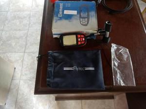
Mm, dd’mm’ss file formats: compegps (gpx) easily manage waypoint lists for each flying site routes capacity: 1 route, with up to 50 waypoints entry: selection from waypoints list race route: start time, number of start gates, exit or enter start, start gate interval with start assistant navigation goto: direction graphic with numeric heading and distance to waypoint route: manual or automatic advancement of waypoint graphic direction to next and subsequent waypoint, numeric direction and distance to next waypoint speed over ground current glide ratio (l/d) required glide ratio (l/d) to next turnpoint wind: direction graphic, and numeric direction and speed last thermal: graphic and numeric direction and distance units for distance: km or miles airspace indication of direction and distance to nearest restricted airspace acoustic and visual warning before entering restricted airspace graphic navigation aid for quickest exit of restricted airspace recording internal logbook: 50 flights: date, start time, duration, max altitude, max climb and sink rate flight recording in igc format recording interval: 1 s to 60 s record time: 100,000 hours at standard recording interval (10s) pc connection micro-usb connector no connection driver/software required compatible with windows, osx, linux, android (through otg cable) drag and drop file exchange (flights, waypoints, airspace)variometro flytec element +soporte nuevo parapente paratrike robust, shockproof abs housing, matte black with green trim tactile keypad with glove-friendly keys, high-contrast display dimensions: 138 x 74 x 23 mm weight: 178 g (including batteries) power supply: 2x aa batteries (alkaline or nimh accumulators) battery life: ~35 h operating temperature: 14ºf to 122ºf or -10°c to 50°c languages: english, german, french italian, spanish altimeter units: m / ft resolution: 1 m or 1 ft range: up to 40,354 ft or12,300 m qnh: air pressure indication in hpa or in hg alt 1: absolute altitude alt 2: choice of absolute or relative altitude variometer units: m/s or fpm graphic indication: ±2000 ft/minor ±10 m/s graphic resolution: 40 ft/minwpt), ozi explorer (2 m/s numeric indication: ±30,000 ft/min or ±300 m/s numeric resolution; 10 ft/min or 01 m/s averager: selectable from 1 s to 30 s acoustics volume: 4 levels vario profiles: five predefined (weak, regular, strong, ridge soaring, balloon) - individually adjustable climb tone: selectable lower threshold, frequency and cadence modulation near-thermal tone: selectable lower threshold and volume adjustment sink tone: selectable upper threshold and volume adjustment stall alarm: selectable threshold (requires optional airspeed sensor) additional vario adjustments: base frequency, and modulation airspeed requires optional sensor units: kph, knots, mph range: 0 to 74mph or 0 to 120 kph, resolution 1 mph, km/h, kt calibration: ±50% gps gps-receiver with 48 channels position determination at 1 hz waypoints capacity: 200 waypoints entry: store current position, manual entry, load waypoints from file coordinate formats: dd
Argentina